In the heart of nature lies Kamp Menina, a true sanctuary for outdoor enthusiasts and adventurers. Surrounded by breathtaking landscapes, it offers some of the most beautiful hiking trails in the region, ideal for those seeking to reconnect with nature. Whether you’re looking for panoramic views, peaceful forest paths, or the soothing sounds of flowing rivers, Kamp Menina has something for everyone.
In this guide, we will take you through the 9 most scenic hiking trails near our camp, each offering unique charm and unforgettable experiences. Put on your hiking boots, pack some snacks, and embark on an adventure to explore the natural beauty just a step away.
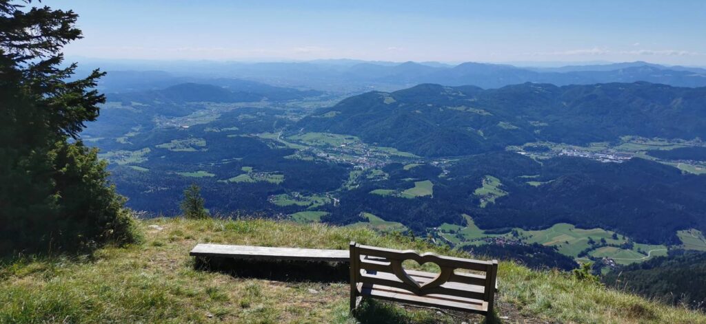
Javorca is a beautiful vantage point on the Golte plateau, located at the upper edge of Požganija. The very name Požganija hints at the history of a fire in this area, and the traces of this event are still visible today. Official records state that the fire broke out on July 5, 1950, although local stories claim that the smoldering started a few days earlier in one of the ravines.
According to local legend, the fire was started when a horse trader and a shepherd set fire to the remains of a 700-kilogram bull that had fallen into a ravine. Due to the challenging terrain, the dead animal was only discovered after several days, and then it was doused with gasoline and set on fire.
You can drive to the small village of Žekovec, and from there, hike up from the parking lot to the Mozirska Hut on Golte. The hike to the hut takes about 2 hours, depending on your physical fitness, and it is also suitable for families. The trail mostly runs through the forest, and you will cross the main road leading to Golte three times.
From Mozirska Hut to Javorca, there is a 30-minute hike remaining. Simply follow the signs for Javorca–Boskovec. The trail mostly goes through the forest and is marked as an easy route.
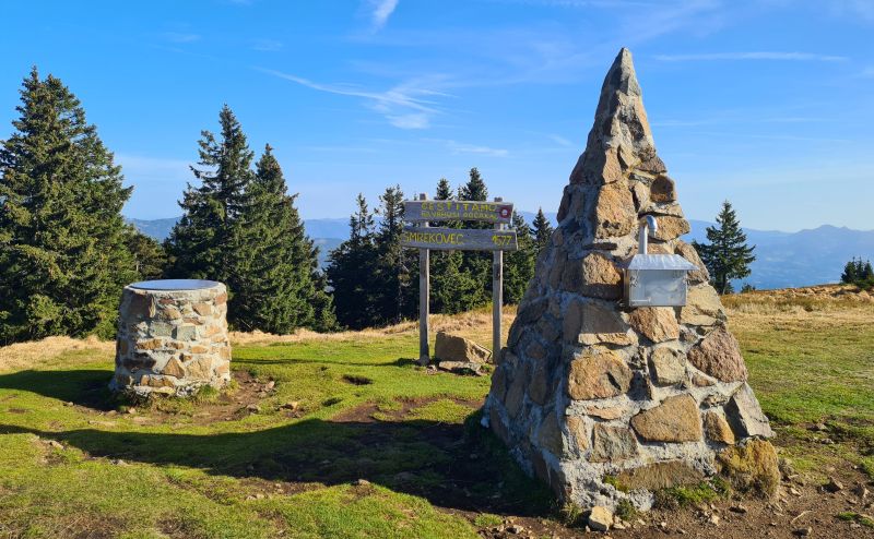
Smrekovec is a mountain of volcanic origin.
There are two easy routes leading to the summit of Smrekovec. You can drive to the Alpine Garden on Golte, from where a pleasant walk through the forest awaits you. The trail is marked as easy and takes about 2 hours to reach the hut below Smrekovec, where you can stop and try homemade apple or blueberry strudel and homemade tea. From the hut to the summit of Smrekovec, there is an additional 20 minutes of uphill walking.
You can also hike to Smrekovec from the small village of Bele Vode near Mozirje, which will take about 1.5 hours to reach the hut, followed by an additional 30 minutes to the summit.
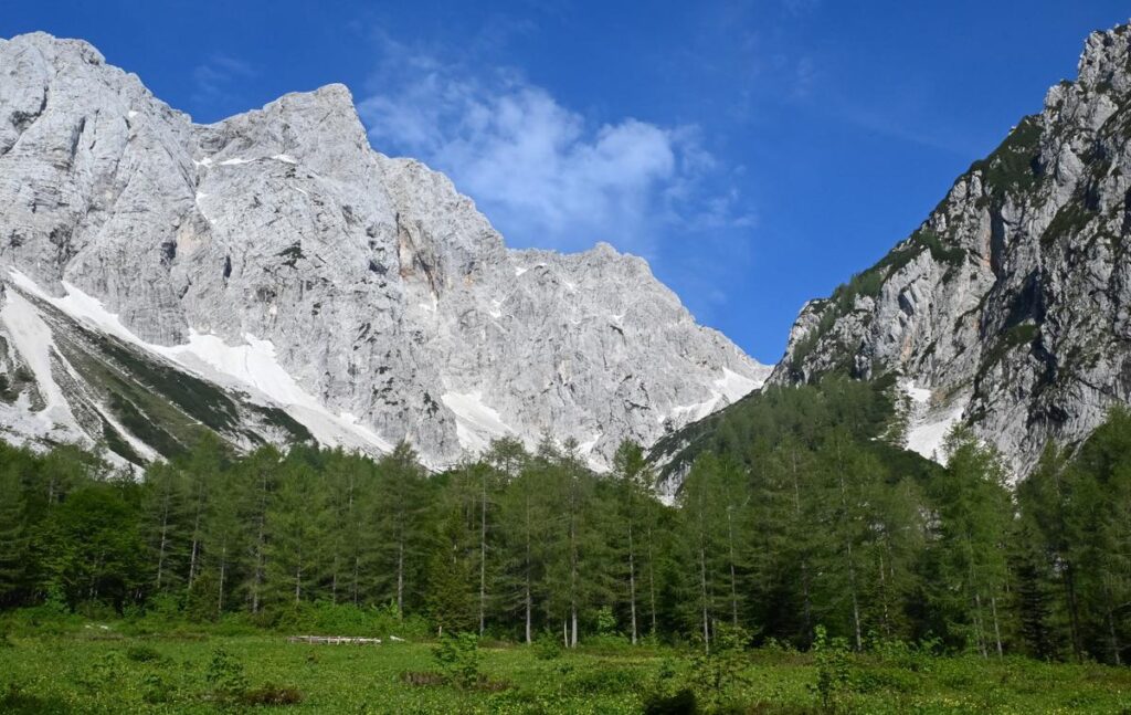
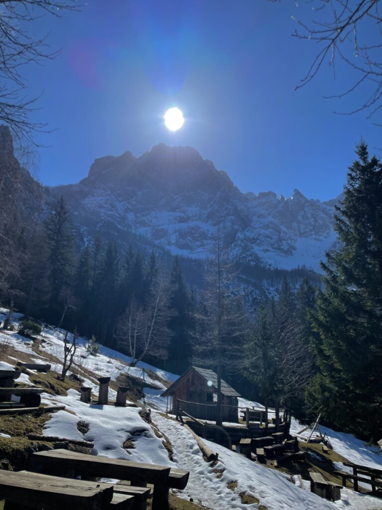
The hut at Okrešelj is located above the Logar Valley, beneath the cliffs of Brana and Turska Gora. From the hut, there is a beautiful view of the northern walls of the Kamnik-Savinja Alps. The hut burned down a few years ago and is in the process of being rebuilt, but nearby, you can find a smaller shelter where you can get something to eat and drink. The hike from Logar Valley is suitable for families, as it is a pleasant walk through the forest, where you will cross the Savinja River several times. In about an hour, you will reach the Okrešelj plateau.
The hut is located on the picturesque Klemenšek pasture. From the hut, there is a beautiful view of the peaks and cliffs above the Logar Valley. The most stunning view, however, is to the south, where Ojstrica rises above the plateau. About ten minutes of walking from the hut towards Strelovec and Krofička, you will find the thickest larch in Slovenia. Its circumference at a height of 130 cm is 464 cm, and its diameter is 147 cm.
From the Planincev Lodge in Logar Valley to the hut, it takes about an hour of walking, but the trail is quite challenging in some parts, so it is suitable for those who have some experience with hiking in the mountains.
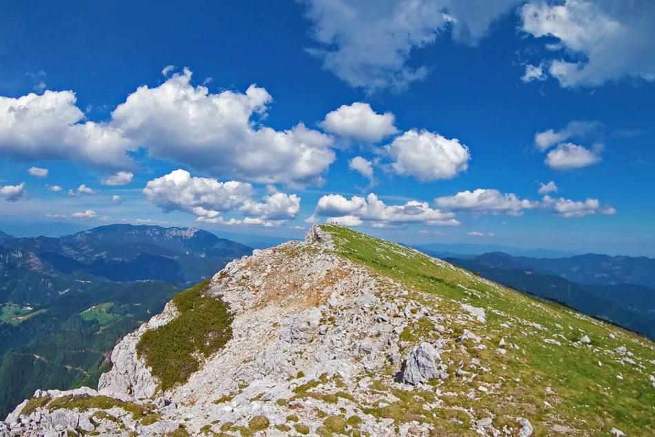
Raduha is a 2062-meter-high mountain in the eastern part of the Kamnik-Savinja Alps, separated from the central group by the deep gorge of the Savinja River. From the summit, a beautiful view opens up of the highest peaks of the Kamnik-Savinja Alps, as well as Olševa, Peca, Uršlja Gora, Travnik, Komen, Golte, and most of the peaks above the central part of the Savinja River. A gravel road leads to the hut at Loka, where you can park and follow the marked trail towards the summit of Raduha. The trail to the top is marked as an easy hiking route, and in about an hour and a half, you will reach the summit. On your way back, stop at the Hut at Loka, where you can enjoy a coffee, delicious homemade strudel, and rest in the untouched nature.
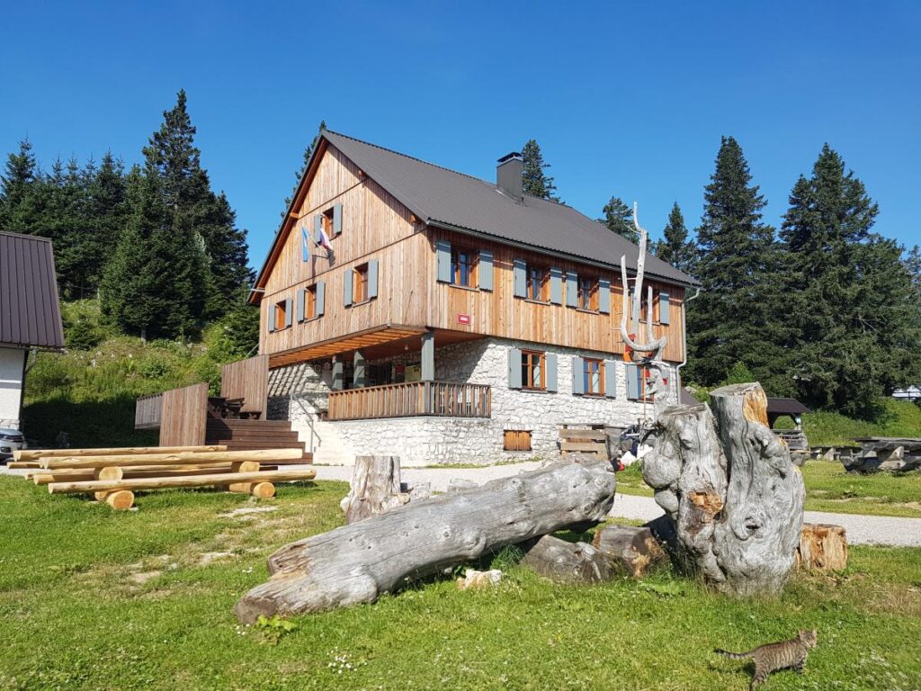
The hut at Menina Planina is located by a large meadow, offering a beautiful view of the highest peaks of the Kamnik-Savinja Alps. Near the hut, which is open during the summer season and also on Saturdays, Sundays, and holidays during other times of the year, there is a children’s playground. On the other side of the plateau, there is a small chapel, just a 15-minute walk from the hut.
Those who are better prepared can hike to Menina Planina from Gornji Grad, which will take about 3 hours. Those less prepared can drive to the parking lot at Usrani Klanci, which will take about an hour of walking to reach the hut. Alternatively, you can drive to the top, park near the hut, and explore the plateau on foot.
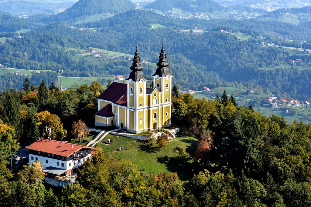
Mount Oljka is a hill located east of Šmartno ob Paki. At its summit stands the Church of the Holy Trinity, built in the mid-18th century. Just a few meters below the summit is a mountain hut, which is open every day except on Mondays.
Drive to Rečica ob Paki, where you can park your car by the railway track. Soon, you’ll notice signs along the road that guide you to the village. The marked path through the village partly follows the road and partly goes along a footpath. When the road ends, continue past the last house in the village. It will take you about an hour to reach the summit. We recommend trying their blueberry strudel.
Kašna Planina is located northeast of the 1,435-meter-high peak of Kašna Planina (also known as Kranjska Reber), at the edge of a picturesque grassy ridge. From the pasture, where livestock graze during the summer months, there is a beautiful view of Rogatec, Lepenatko, Golte, and Menina Planina.
You can park your car across the road at the Črnivec Inn, where you’ll find a large parking area. At the parking lot, you’ll notice red signs for Kašna Planina, Lepenatka, and Veliki Rogatec. The hike to the summit of Kašna Planina takes about an hour and a half, following the marked trail. There is also a road that leads almost to the top, which is very fun in the winter as it is ideal for sledding.
On your way back to the car, don’t forget to visit the Črnivec Inn, where you can enjoy a delicious meal.
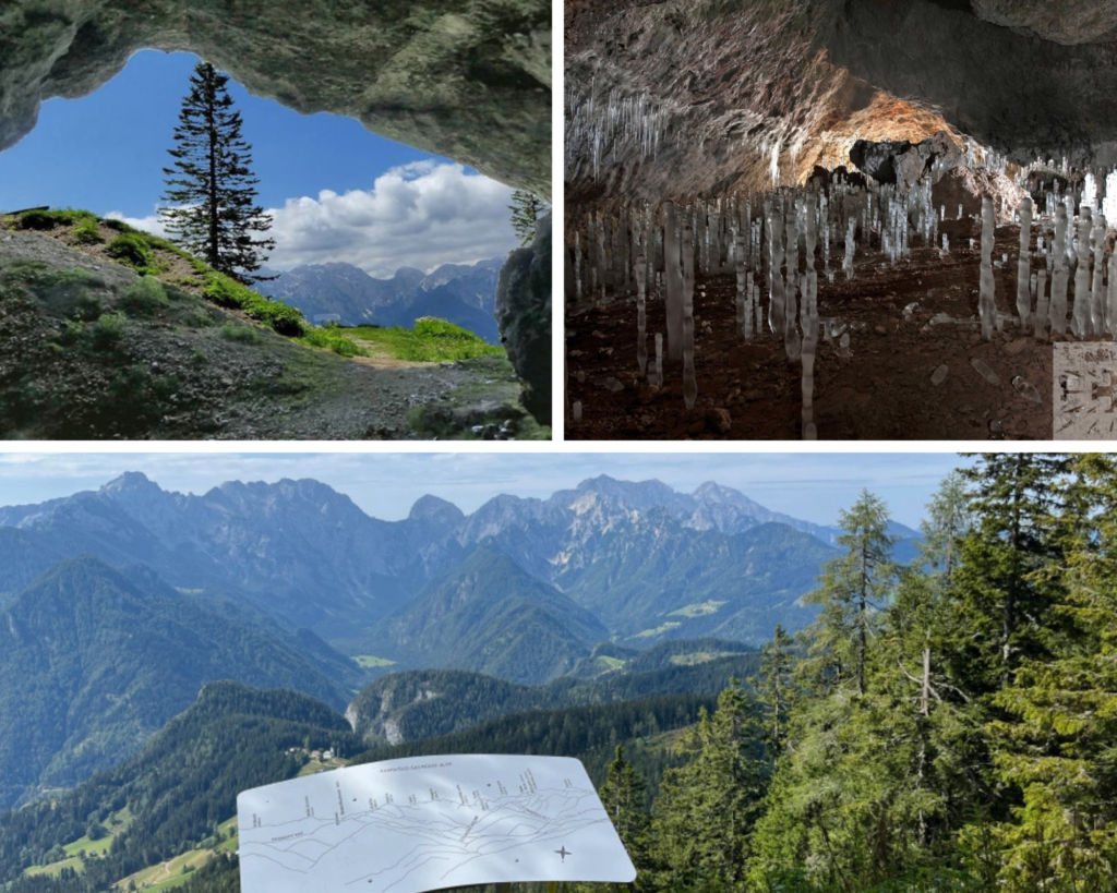
Potočka Zijalka is a 115-meter-long and 20 to 40-meter-wide karst cave located on the southern slopes of Olševa. In 1928, Professor Brodar discovered an ancient stone-age dwelling that dates back 40,000 years. Forty animal species were identified, one of which was the cave bear. In addition to the animal remains, bone and stone tools, as well as traces of hearths, were found. The historical material is stored in the Regional Museum in Celje.
The trail is easy and marked, making it suitable even for families with children. Drive towards Logar Valley, and in the village of Solčava, leave the main road and turn right towards Podolševa. Follow the road to the intersection, where you turn left towards the panoramic road. Park about 100 meters before the church, near the Rogar farm.
Ostanite na tekočem z dogajanjem v Funpark Menina športnem centru!